Crossing Boundaries Curriculum
Exploring Biodiversity Using Information Technologies
The series consists of four books that collectively engage middle and high school students in using information technologies to investigate real-world scientific and environmental questions in national and international contexts. Geospatial technologies (Google Earth, GIS, and web-based maps) and other information and communication technologies (wikis, blogs, podcasts, databases, etc.) provide students with opportunities to analyze spatial data relationships, formulate scientific explanations, and develop communication skills.
Birds Without Borders: Investigating Populations, Habitats, and Conservation Needs of Birds in the U.S. and Abroad
Published 2015 - Now available!
Students use citizen science and other data to address questions such as why bird habitat requirements vary from species to species and why habitat protection for some must span states, countries and continents.
Biodiversity Investigations: Introducing Ecological Concepts and Applications
Students learn the meaning of key ecological terms and grapple with geospatial data to reach conclusions about various aspects of biodiversity, followed by a field investigation in which they apply these concepts in a local setting.
People and Wildlife in the Amazon: Using GIS to Manage Tradeoffs in Siting Wilderness and Multiuse Reserves
Students manipulate and analyze web-based GIS maps to site a new wilderness preserve and a multi-use reserve in Brazil.
Wildlife Conservation in the Kenyan Savanna: Seeking to Balance Social, Economic, and Scientific Interests
Students use Google Earth and real-world simulation to learn about wildlife, habitats, and trophic levels and then create a land management proposal that strives to balance the social, economic, and scientific concerns of various stakeholder groups.
Nature of the Curriculum
Crossing Boundaries lessons, materials, and resources reflect best practice in science education and will help teachers address some of the more difficult aspects of the Next Generation Science Standards (http://www.nextgenscience.org/) and Common Core Standards (http://www.corestandards.org/). The lessons use authentic data applied to relevant real-world issues, ensuring that students are engaged in active learning and critical thinking. Paralleling approaches used by professional scientists, students analyze geospatial data, make management decisions, weigh alternatives, and present their conclusions through oral presentations, podcasts, wiki pages, maps, and written reports. Non-fiction texts are included in ways that provide students with authentic settings in which to read, discuss, and use information.
Free Lessons and Resources
A Bird's Eye View of Changing Landscapes
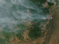
Students view landscape change over time and predict potential impacts on biological communities. Using pairs of current and historical satellite images in Google Earth, students explore landscape change in U.S. and international settings. Based on these observations, they predict potential effects on associated plant and animal communities.
Bird Island: What is Biodiversity?
Through spatial and graphical analysis of bird populations on a fictional island, students learn the meaning of biodiversity, species richness, endemism, and abundance. Using an interactive PDF map, they explore various ways to represent and compare biodiversity across regions.